Walking on Water
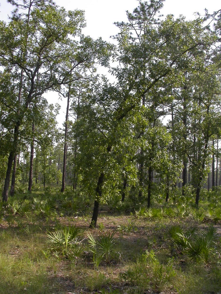
... in the Florida flatwoods, it's easy

When my parents installed a well for their house in Connecticut, the well-driller finally hit a “water vein” at about 150 feet. It seems to have tapped into a crack in the metamorphic bedrock into which groundwater sort of seeped from, what? other cracks? Maybe. It was notoriously unreliable, and if two guests enjoyed a shower within a one-hour period, the reserve tank would be skirting empty. In many parts of the western USA, groundwater is available, more or less, below 200 or 300 feet, and falling rapidly as people pump it up for their use. Picture the work (energy) it takes to pump that water to the surface! You’re drinking kg-m!
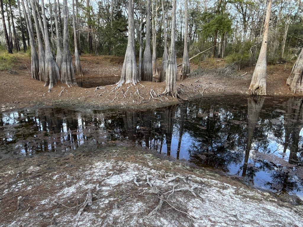
But here in the Florida coastal plain piney flatwoods south of Tallahassee, ground water and surface water are a sort of continuum, except that ground water has a covering of sand, and surface water doesn’t, so it looks like water, with reflective surfaces and little ripples. So if you are walking around in the piney woods, you are, more or less, walking on water, for in most places the groundwater is less than a meter or two below your feet, and if you go far enough in almost any direction, you will struggle through titi or bay swamps that have their feet in wet soil and sometimes in water. Few places in North America prepare you for the quirkiness of the flatwoods.
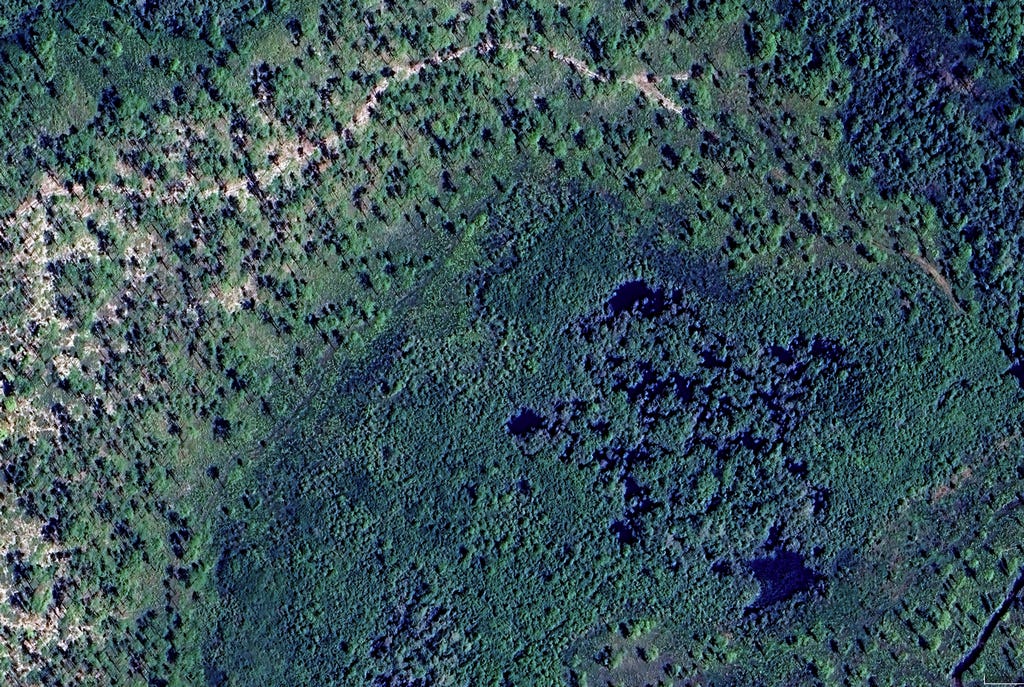
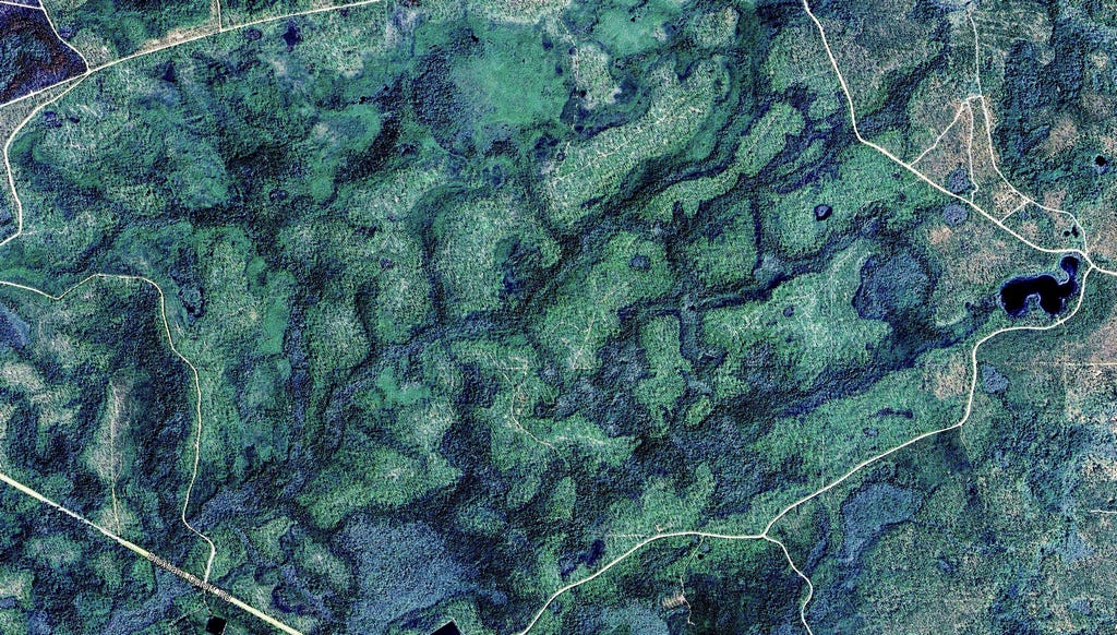
This is because most of the coastal plain of the Florida Gulf Coast was accreted as a series of offshore barrier islands and mineral-poor sand dunes over the last few million years, starting from the old Miocene coastline just south of Tallahassee. The orientation of ancient beach fronts and wet back bays is still apparent on satellite images today.
This depth-to-groundwater is a key ecological feature for most of the plants and animals because it determines where in these piney flatwoods plants and ants can make their home. Some, for example harvester ants and turkey oaks are found only where the water table is more than a shocking 1.5 meters below the surface. Their association is as reliable as foam and beer.
Others, such as “epigaeic” crayfish, occur reliably in the gallberry zone where the groundwater and surface are in hand-shake distance along the margins of wetlands, where they build their sand chimneys only a few centimeters above the water. These so-called aquatic creatures forage on the ground surface at night and return to their flooded burrows during the day. In the flatwoods, below-water and above-water are in a dynamic dance and the crayfish know the tune.
Rain is the source of all groundwater, but rain and the water table are not in a one-to-one relationship because only about 40% of this sandy soil is pore space, i.e. air. The depth at which these pores are filled and can hold no more is the water table. It therefore only takes 0.4 cubic cm of water to saturate 1.0 cubic cm of dry sand, with the result that 1 cm of rain raises the water table at least 2.5 cm. Above the water table, soil holds water by capillarity. As you might expect, the actual water table depends on the amount and timing of rain, causing the water table and pond levels to rise after rains and to fall again as the nutrient-poor water drains slowly to the Gulf. This fluctuation can be quite large, and is especially evident in cypress swamps after long droughts.
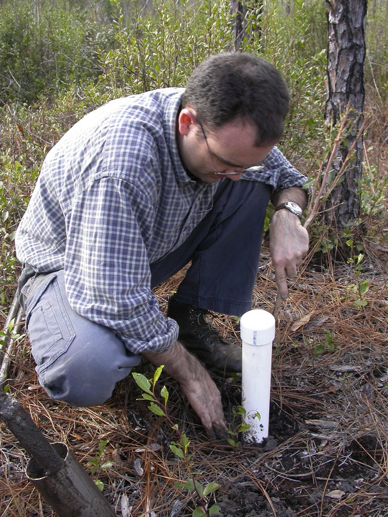
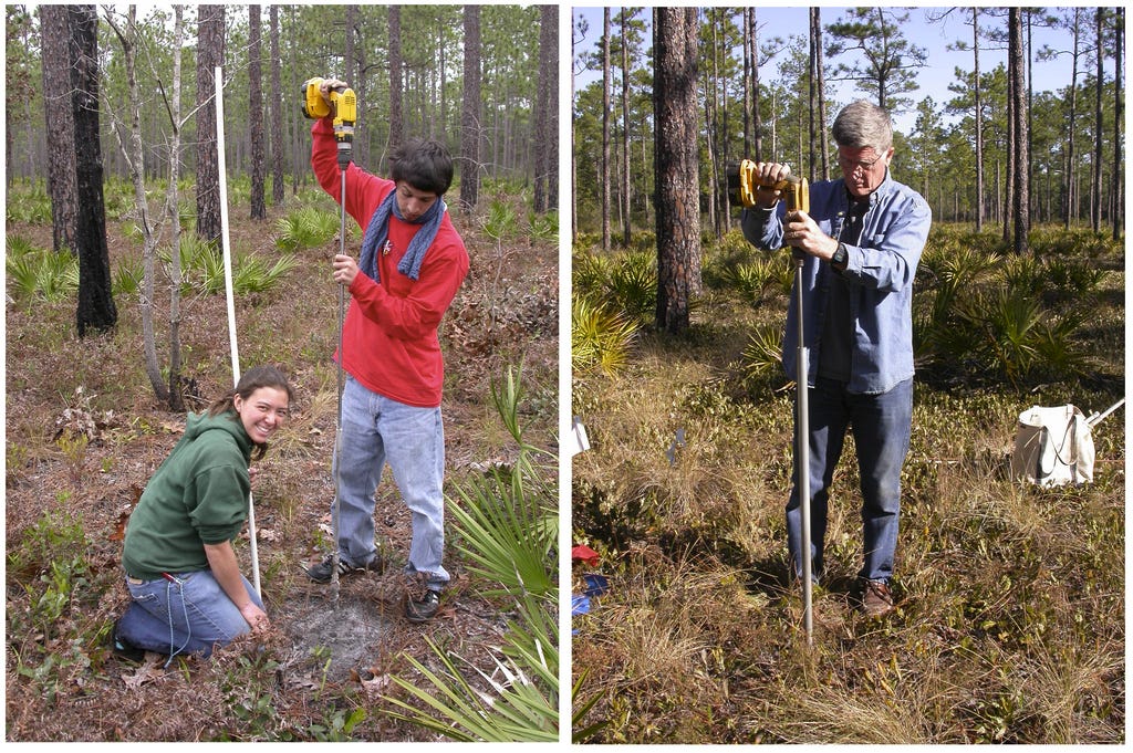
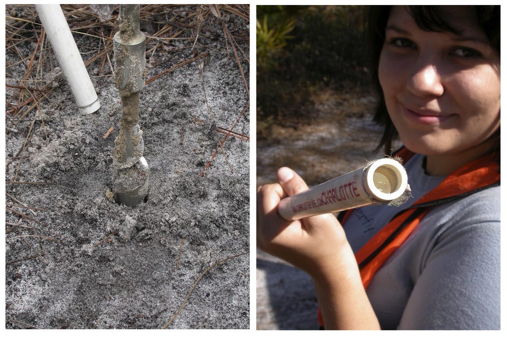
Given these vagaries of rainfall, the importance of measuring the depth-to-groundwater in our ant studies should be apparent. My early efforts relied on sections of 4” PVC pipe screened at the bottom and sunk into a hole made with a four-inch soil corer, then capped to keep critters from falling in. The depth of the water table could then be read by dipping a calibrated stick into the accumulated water.
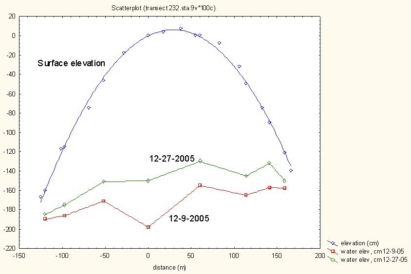
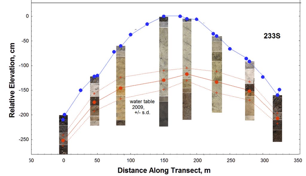
A transect with these test wells made the variation of the depth-to-water in relation to rainfall very obvious, as in the example graph below. There had been substantial rains between December 9 and December 27 in 2005, raising the water table. Such variation was pretty typical, emphasizing that from the biological point of view, it was the average water table that counted. Sure, after serious deluges, some of the lower-lying ant nests might have to vacate their deepest chambers, but the ants already “knew” that this was a risk and were probably not too fussed over it.
During the installation of our 4” wells in the transect study, our soil corer brought up sand of greatly varying color and coherence, the result of complex chemical action. We laid these out on boards for photos such as the example from near a “hilltop” below.
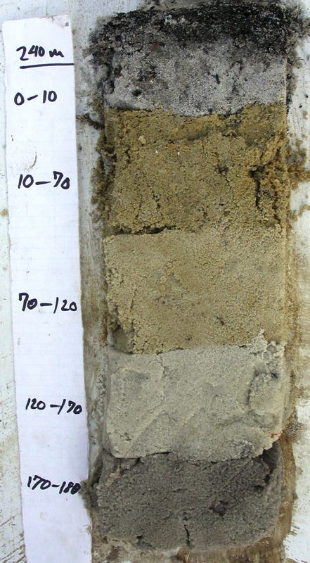
Flatwoods soils are not “soils” in the sense that they were formed and weathered in place from parent rock, and differentiated into distinct “horizons.” They are classified as “spodosols”, a widespread kind of acidic, nutrient-poor Florida soil, especially prevalent under flatwoods pine forests. Their colored layers are studies in greys, yellows, browns, whites and blacks, and are created by percolating rain water acidified with carbon dioxide and humic acids from the incomplete decay of plant matter. This mobilizes and leaches aluminum compounds (and less so, iron) downward. Starting at the top, there is a 10 cm thick, grey, charcoal-containing surface layer bound by pine rootlets, under which lies a yellowish zone in which the grains are coated with ferrous oxide (aka limonite). Below this, all colored compounds, both organic and inorganic, have been leached away to form a white or light gray zone of clean quartz sand grains. Below this lies the very dark zone that accumulates at depths as a black to reddish-brown “spodic” layer where the leached aluminum and iron is deposited as insoluble complexes. This layer is more or less coincident with the average water table—- its minerals are often not available to plants when the water table is seasonally high. The spodic zone is often much firmer, holding together as chunks (technical term), to the extent that ants excavating through this harder layer form more closely-spaced chambers.
But these processes are not uniform across horizontal space, so the zones along any transect are a kaleidoscope of browns, yellows, whites and blacks, depending on the vagaries of leaching and deposition. Soils near the wetlands are much darker and less variable.
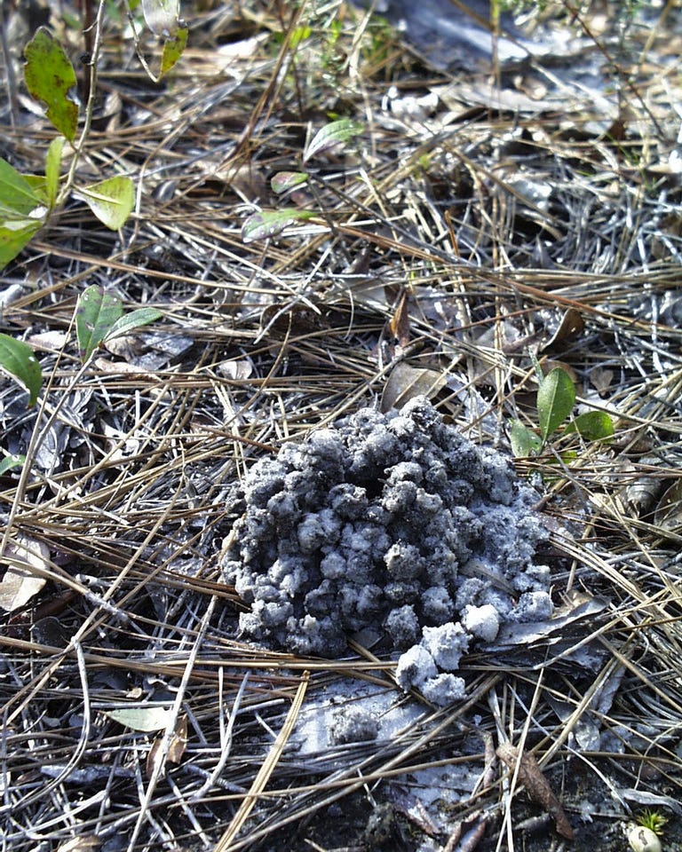
As an aside and perhaps surprisingly, the very slight solubility even of sand itself (i.e. silicon dioxide) plays an important role. I once visited a place in Guyana in which the surface was littered with thousands of pisoliths, insoluble concretions of iron, silica and aluminum. These had been formed in a deep sandy soil, and remained behind as thirty to a hundred feet or more of that sand had been dissolved by rain water and carried away.
The 4” pipe test wells worked just fine, but when I wanted to increase the number of sites with more closely-spaced test wells, using 4” PVC pipe was too expensive, too cumbersome, and too much work to install. So I changed to using 1” PVC pipe dropped into holes drilled in the ground with a 1” ship augur on a very long shaft driven by a battery-powered drill. It was easy and fast, but if you drilled below the current water table, the water and sand poured into the hole, filling it. So we would drill inside a steel conduit pipe that we pushed down as we drilled. It worked “real good” even below the water table, and then we still got readings as the table fell during droughts.
But measuring the water level in these skinny pipes turned out to be a problem. You might think it is easy to just stick a stick into the pipe and measure the distance to where the stick is wet as we did in the 4” pipes. But not so quick! Because the stick and the 1” pipe are not that different in diameter, the farther the stick was inserted below the water level (which you couldn’t see), the more it raised the water level to give false readings.
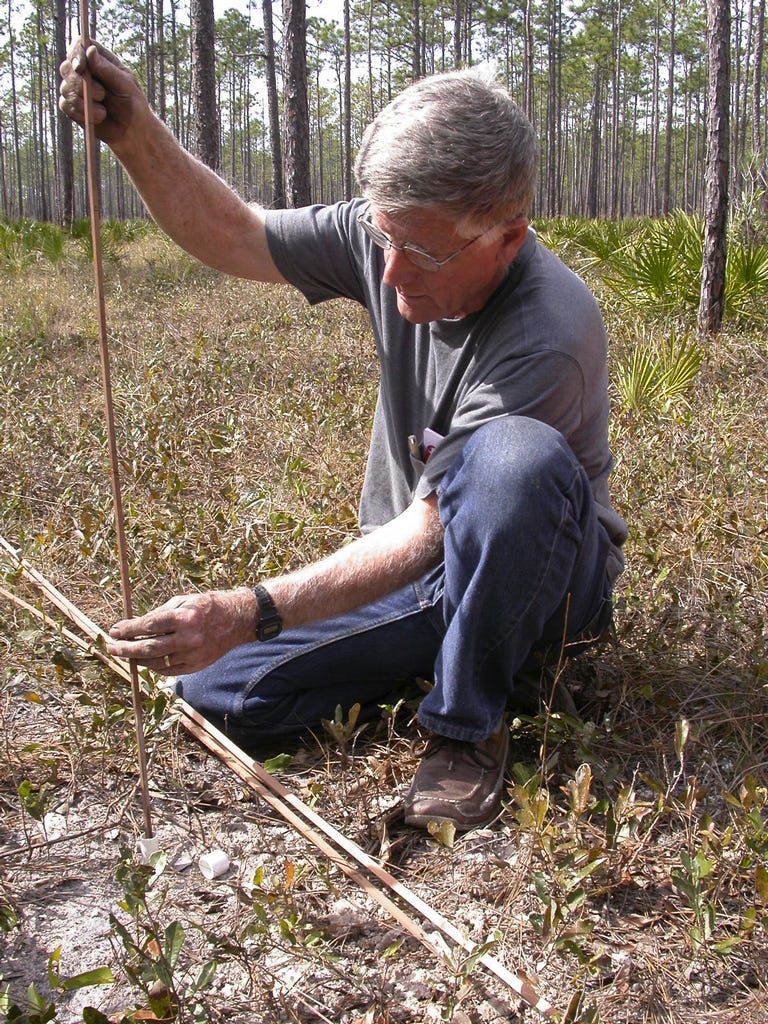
There was no way to see when the stick first touched the water. What was needed was some way to detect first contact with the water, and I came up with the gizmo below.
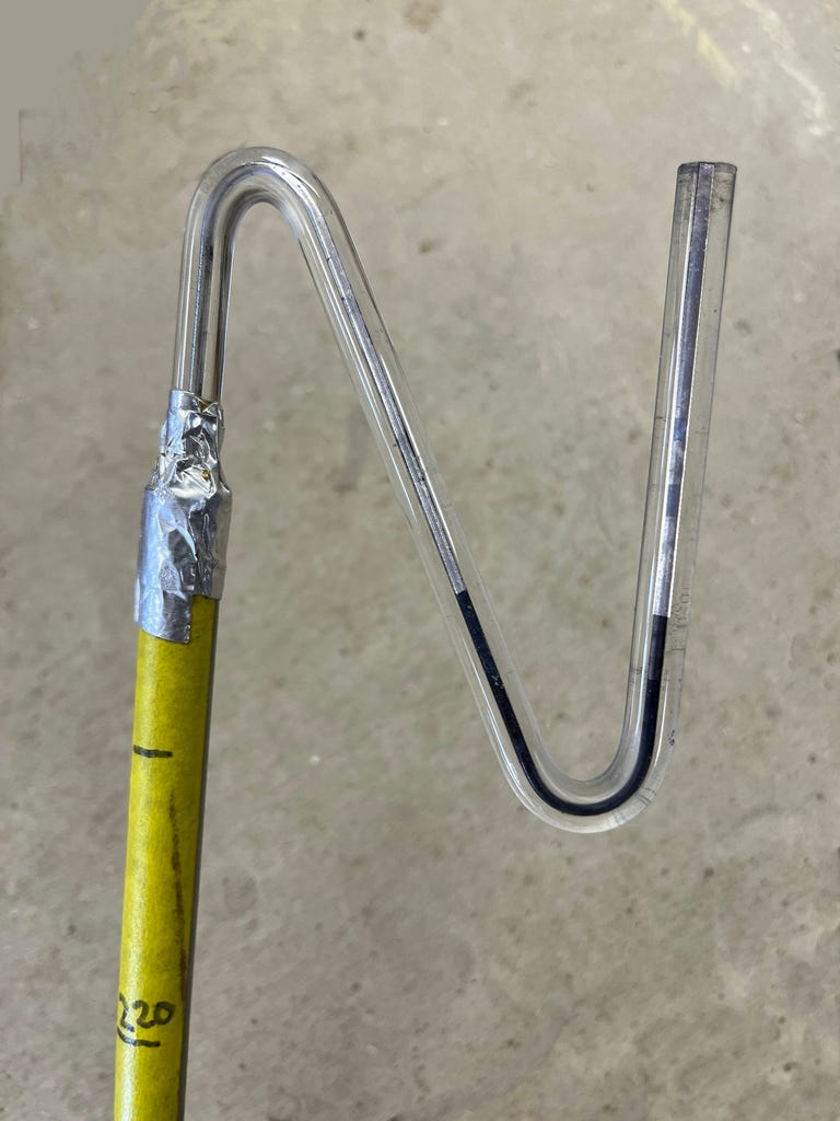
The gizmo is a long, calibrated aluminum tube with an S-curved glass capillary tube attached to its upper end. A bit of blue liquid sits in the bottom of the S. When the lower end of this tube contacts the water in the skinny PVC wells, the air in the tube becomes a sealed volume, and pushing it even the slightest amount below the water surface causes the blue liquid in the capillary to move to the right, and allows depth-to-water to be measured quite precisely.
We sunk arrays of a dozen or more of the 1” PVC test wells in each of our nine plots at five different study sites, and also measured the ground elevation relative to the highest point with a level and calibrated survey pole, just like real surveyors. These data were fed into a plotting program that spat out contour maps of the ground elevation on the one hand (black contours), and the depth to water on the other (color map). The two measures were well correlated to each other, but not perfectly, because movement of ground water is influenced by more than elevation of the ground overhead.
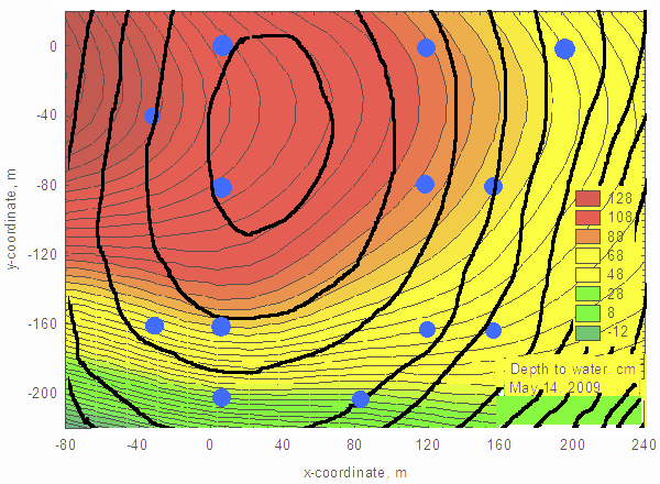
Our wells revealed that a second, invisible, watery topography lay under our feet, like an imperfect shadow of the fossil beach dunes we walked on. Its hilly nature meant that water flowed below ground from high to low much as it did above ground. Where does all this water go? There are few creeks or streams that drain this mosaic of piney woods and wetlands.
Gravity wants to bring all earthly topography to the same level, be it mountains, hills, or subsurface water tables lurking underfoot. The rate at which this leveling occurs is vastly different for each of these. Over millions of years, through erosion and transport, gravity carries mountains onto plains and into the sea, a process too slow to see. By comparison, the Leveling-of-the-Waters in the flatwoods is like lightning, measurable in days or, in some places, even hours after a heavy rain—- rising fast and falling more slowly.
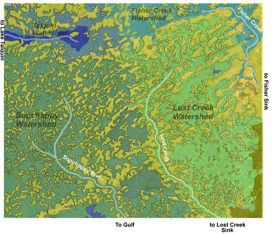
As gravity levels these invisible water-table hills, the water under the wetlands rises, and if it rises enough, it becomes surface water, pooled in swamps or flowing sluggishly down whatever slight slope lies hidden among the dense thickets of titi or tall hardwood swamps, places that are hard to get into and that most sensible people avoid. The path of this flow is never direct, and zig-zags between pine uplands and inter-dune wetlands (see image below). But even without surface flow, water slowly makes its way underground toward the Gulf of Mexico down a slope averaging less than four or five feet per mile, too gentle to see. This slow, variable, intermittent flow, both visible and invisible eventually combines into three streams of acidic, stained, “black water”, sweet to the tongue, the color of strong tea, rendering objects red at depth —- Fisher Creek, Lost Creek, and the Sopchoppy River. Of these, only the Sopchoppy reaches the Gulf of Mexico directly. The other two mysteriously vanish into sinks south of Tallahassee, probably eventually emerging as springs under the Gulf, the final quirk of a quirky water-scape below a quirky landscape.
Your essays give me a much clearer sense of what an ecological scientist (if that’s the right term) actually does in their research. Enlightening! 👏
'capillarity'...I like that...